Stony Hill Nature Trail

02_stonyhill06_BLHW.JPG

The Bois Brule River (translated from Ojibwe meaning “burnt wood”) is a revered and storied waterway, with hundreds of years of tales to tell. The ancestors of the birch trees along the riverbanks provided inspiration—and raw materials—for the earliest canoes of the Chippewa. The intrepid voyageurs followed during the heady days of the fur trade. Canoeists on the Brule today enjoy the same postcard scenery around every bend, including a few colossal white pines soaring skyward, providing ideal perch and nesting sites for bald eagles.

02_stonyhill05_BLHW.JPG

I’ve mentioned the Brule with affection and reverence on many occasions in my books and this chapter celebrates the river from on high. This short, exhilarating hike leads to the top of Stony Hill with an overlook perched above the river valley for a predictably stunning view including Little Joe and Doodlebug rapids far below.

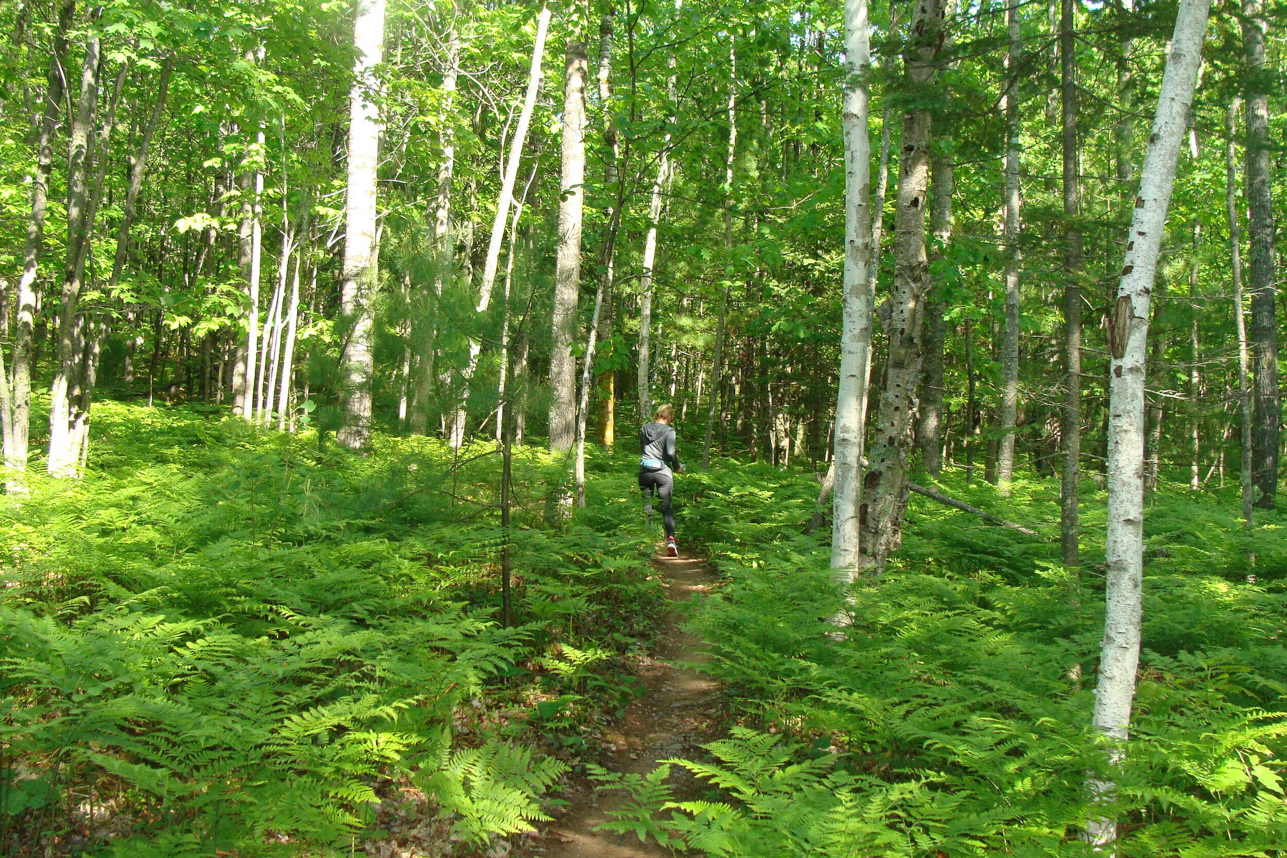
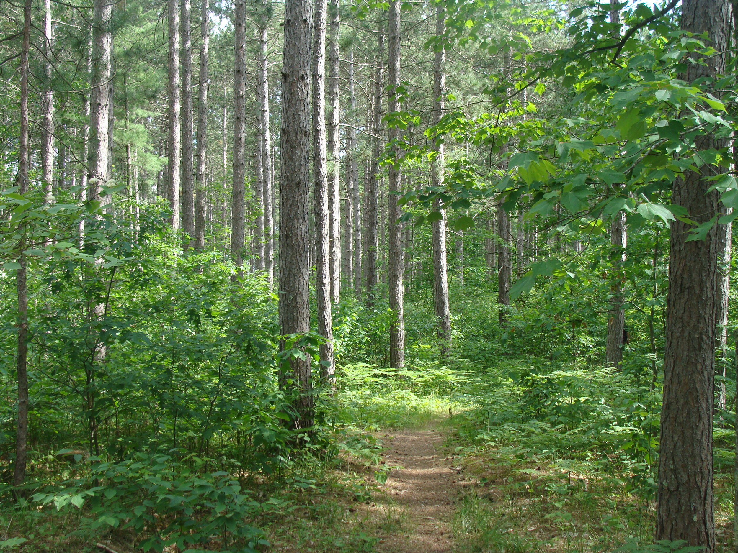
Breathing deep of the forest’s smells and spirit is sweet elixir in its own right and this trail complements the experience with interpretive signs packed with engaging information and stories about this area’s rich history. In fact, hiking the loop clockwise (as related here) takes you on a past to present tour while counter-clockwise is a back-in-time trek. From the trailhead, the cozy trail curves gently through a stand of skyscraping red and white pines on delightfully spongy tread made of layers of pine needles and organic duff.

02_stonyhill08_BLHW.JPG

Take a moment to reflect to the proud and deep past of the Sioux and Chippewa Indians living here long before the appearance of European explorers and settlers. The river valley provided abundant hunting grounds and locations to establish camps, two ingredients that also attracted fur traders that leveraged the Brule as a critical route inland. One legendary explorer, Daniel Greysolon DuLhut was tasked with traveling here to inspire peace between the Sioux and Chippewa and ensure continued success of the fur trade.

Along the trail are markers emblazoned with a bare foot (left one) for a fun take on leading the way and they soon take you to the summit of Stony Hill. A pair of benches await for extended lingering and ogling time of the valley. The last stretch of trail from Stony Hill is downhill, for an easy cruise back to the trailhead.

Why this place matters

The Brule River State Forest host three distinct ecosystems in the Lake Superior Clay Plain, Mille Lacs Uplands and Bayfield Sand Plain, making for a highly diverse landscape including more than 40 endangered and threatened animal species. The area also retains a unique potential for restoration of boreal forest spruce-fir cover along with pine, birch, cedar, maple, aspen, and tamarack.

Copper Falls State Park

The Alps of Wisconsin? Yep, if you were around 500 to 600 million years ago (give or take a few), this was the place to be for world-class mountaineering and gnarly skiing. The 80-mile-long Penokee Range (also known by its Ojibwa name, Gogebic Range) is one of the world’s oldest, predating animal life on land. These hills once soared to more than 10,000 feet, with snow-covered summits and deep, verdant valleys, and the ridges of the Penokee are still among the highest in Wisconsin, rising about 800 feet above Lake Superior’s surface.

Two hundred million years of erosion sculpted what we see today, accompanied by glacial artistry that left behind a handful of lakes and spruce-tamarack bogs. This is a very special place indeed, filled with rich forests of birch, aspen, and maple mingling with balsam fir, white pine, cedar, spruce, tamarack, and cedar. Bogs and grasslands border the higher hills, and animal life like you saw in the wilderness areas to the west settle here in abundance.

This hike is another of my go-to favorites for adventure and breathtaking scenery, with two calendar-shot waterfalls way down in deep, rocky gorges on an exhilarating loop trail. North Country rugged mixed with old-time charm fills the air every step of the way. The picnic area and main grounds near the trailhead are dotted with log buildings masterfully created by Civilian Conservation Corps members in the 1930s, surrounded by rich forests of hemlock, pine, sugar maple, birch, and basswood. Within the woods are dozens of wildlife species including tiger swallowtail butterflies, frogs, deer, pileated woodpeckers, and loons.

Start this fun hike at the parking area and immediately cross a short footbridge over the Bad River. At the top of a gradual rise is the junction with the trail to the observation tower. Lots of stairs climb the steep ridge and a few more take you to the top of the tower for beauteous views of the forest unfurling in all directions and Lake Superior way out there to the north.

A wide, manicured stretch of trail leads to an overlook of Copper Falls, dropping about 29 feet in a collection of mini waterfalls flowing over jumbles of boulders. From here, the trail rises to another overlook with stellar views of Brownstone Falls shinnying through 100 feet of sandstone and black shale. Continue hiking along the ridge above the steep walls of Devil’s Gate to a flight of stone steps descending to the river. This is a great spot to wander on sandbars and get up close to the river.

Follow the bridge over the river and turn back eastbound, climbing back up to the top of the northern ridge and past the junction with the North Country Trail’s arrival to the park’s main attractions. A little farther on is a short spur trail leading to yet another overlook above the river, this time with great views of the confluence of the Tyler Forks River’s confluence with the Bad, Brownstone Falls, and the Tyler Forks Cascades. Keep hiking along the river to a bridge just upstream from the cascades, and loop back past a couple more overlooks on the homestretch to the trailhead.    

Why this place matters

In addition to the 500-acre Copper Falls State Natural Area surrounding its namesake falls, this state park is veritable who’s who of celebrity wildlife. Fishers join white-tailed deer, fishers are plentiful and elk now live nearby. More than 200 bird species live or pass through the park, including pileated woodpeckers, bald eagles and loons. Watch at ground level and water as well for the likes of wood turtles, snakes (non-poisonous) and swallowtail butterflies.

copper.png

Hildebrand Lake Trail

This hike deep in the Chequamegon boasts a trio of way-out-there lakes lassoed by the trail. Caveat about mosquitoes—the woods are full of them in summer and this trail takes you to what surely must be their breeding grounds headquarters. I hiked here in late June and am still recovering from the trauma of impending blood-sucking doom. Early morning hikes are a somewhat better defense, when skeeters are less amped up for human visitors but wandering into their lair is always a gamble. Prepare accordingly with plenty of bug repellant and clothing that covers vulnerable skin.

09_hildebrand05_BLHW.JPG

Scary stories aside, this trail easily ranks as one of my favorites in what is arguably Wisconsin’s most remote lands, filled to the brim with noble forest and fairy tale terrain littered with kettles and boulders and moss-covered logs. CAMBA will tell you this is the most technically challenging trail in their entire system; great fun for fat-tire adrenaline junkies that translates to the stuff of dreams for hikers. Short, punchy hills appear all along the trail, providing additional flavor in seemingly all the right places, but the route’s overall elevation profile looks like a flat-lined heart monitor. That means you can enjoy every step of this gem without quad-busting climbs.

09_hildebrand08_BLHW.JPG

Just over one mile in, after crossing the Rock Lake ski trail, the path drops down a barely-there descent to the northwest shore of Frels Lake, with intermittent views through the trees. After a relaxed hairpin turn you’ll arrive at No Hands Bridge, a renowned trail highlight. The “bridge” is a skinny boardwalk crossing of a little stream flowing from Hildebrand Lake. And I mean skinny—18 inches wide right at the surface of the water, with no handrails. It’s easy enough to walk across but traversing on a bike is a whole different challenge. I love mountain biking as well but put on the brakes when faced with something like this. Cheers to those of you with the skill to shinny over this obstacle, and doubly so to those brave enough to try the optional, even skinnier (6 inches wide!) line. The penalty for inattention or riding above your pay grade? A very wet fall into the stream.

09_hildebrand11_BLHW (2).JPG

It’s a fun perk of the hike, however, and from here the path traces the west and south shores of the lake, with great views along the way. Hildebrand is only about 15 acres,  averages around 12 feet deep, and is stomping grounds to panfish, largemouth bass and northern. Enjoy a couple of rolling stretches as the trail turns back northeast, crosses the ski trail again, and cruises up a nearly imperceptible rise back to the trailhead.   

Why this place matters

If for no other reason, this trail allows us the privilege of immersing in and connecting with some of Wisconsin’s finest and most remote places. Access is easy from Rock Lake Road and the trail takes hikers and bikers past the shores of wild and secluded lakes. The forest as a whole also includes rare plants like bearberry and bloodroot, fens and bogs, and scattered stands of old-growth white pine.

9 Hildebrand Lake Trail.jpg

Plum Lake Trails

20a_plum09_BLHW.jpg

This trail gets my vote for the best off-the-grid, way-out-there remote path. Tucked partly in the Plum Lake Hemlock Forest SNA, this route is part of a wonderfully squiggly maze of a trail system that wanders the woods along the southern shore of Star Lake.

The path mixes it up with get-your-feet-wet close to the water, rugged sections of roots and rocks on punchy little hills, and stretches of calm in the trees. This is yet another of my all-time favorite trails, in large part due to its remote vibe, old-growth forest lineage, and silent invitation to just go out there and connect.

With every step of this hike, know that you are traveling through a near-virgin stand of old-growth forest packed with the likes of relict hemlock, yellow and paper birch, sugar maple, and basswood. Forestry experts tell us that the presence of large, aged white birch means this stand likely was born of a fire event around 1810 with a natural succession of species from aspen to hemlock. Shrub species in attendance include mountain maple, honeysuckle, and elderberry; and below you’ll see mayflower, plentiful emerald-green moss, snowberry, and lots more. Flitting about this paradise are dozens of songbird species, merrily singing away the praises of calling this place home.

20a_plum04_BLHW.jpg

We can join in their song, simultaneously content and proud to be in such good company and treasured legacy. SNAs like this one are Wisconsin’s last refuges for rare plant and animal species. More than 90 percent of plants and 75 percent of endangered and threatened species in our state are protected within SNAs. Many of these places provide critical living laboratories for scientific research due to their visible evidence of natural processes evolving with very little human muddling. And that is the most priceless of heirlooms to share with generations to come.

The entire first half of the loop traces very close to Star Lake’s shoreline with the expected gorgeous views, and the trail is a blast; full of personality in the form of scattered boulders of various girth and of course the resplendent hemlock forest. At the top side of the western loop, the trail skirts around a little pond and it is here where, if you’re ambitious, you can keep right on hiking for the rest of the day.

Why this place matters

The Plum Lake Hemlock Forest SNA was assigned as such in 1953 and boasts rare and humbling examples of big hemlocks, supported with accoutrements such as balsam fir, wood fern, white birch, tamarack, white pine and many moss species. The red-eyed vireo nests here, as does the blackburnian warbler, northern parula, winter wren and hermit thrush.

2020-12-14 (3).png

This AllTrails.com map shows the trail’s general location. Go to https://vilaswi.com/maps/Trampers-Trails.pdf?x18247 for more detail.

Mt. Ashwabay

Hiking trails come in all shapes and sizes, long and short, steep and flat, woods, mountains, desert, you name it. I’ve been very fortunate to set my boots down on all of those and it never fails; sooner or later someone asks, “What’s your favorite trail?” Short of saying they’re all favorites, I dodge the question because every path has its own vibe and drives exhilarating satisfaction into my bones in different ways. But some trails stand out and I find myself grinning in delight literally with every step.

15_mtashwabay02_BLHW.JPG

This is one of those trails. Once again, CAMBA created a beauty. Every inch of tread is impeccably maintained and twists and bends through drop dead gorgeous forest, teases with lower elevation overlooks, and then climbs to a crescendo of cover shot views of distant valleys, Lake Superior, and Madeline Island.

15_mtashwabay04_BLHW.JPG

What’s so great about this place? After all, the “mount” is not exactly Denali-like and purveyors of skiing in the Rockies or Montana or most anywhere else in the world will scoff at Ashwabay’s vertical drop. But this little hill is more than 600 million years old and filled to its modest, rounded summit with equal parts rich geologic history and proud tradition.Heads-up clause: This first part of the hike, on the Hot Saw trail, goes against mountain biking traffic so pay attention. The path immediately dives into forest crowded everything from white pine to aspen, all vying for attention. And the ferns! The ground is fully concealed by waist high fern fields and the path wanders right through in gently undulating squiggles. Along this stretch you’ll meet a little trailside gnome statue decked out in chaps and pointy hat as the trail dips though a shallow ravine and then starts climbing. A brief break in the trees offers a provocative view of the southern tip of Madeline Island and the Ashland breakwater.

15_mtashwabay11_BLHW.JPG

At the top of Mt. Ashwabay, the view is the stuff of daydreams. Straight to the north the valley dips far below and swoops high up again and that’s where all kinds of homegrown organic farms, laced with generations-deep heritage, grow delicious berries, apples and veggies. Look right to see Lake Superior and Madeline Island. This is the proverbial picture-perfect place to stretch out, watch clouds change shapes and listen to birds sing.

Post-lounging, walk along the ridge southeast to meet the Raven Trail. This path follows a gently curving course along the hill’s outer fringe back to Hot Saw and through the ferns to the trailhead.   

Why this place matters

Settled in Mt. Ashwabay’s northwestern shadow, the Nourse Sugarbush SNA is home to huge, old-growth hemlocks and 100-foot sugar maples, with an accompanying cast of birch, red oak, basswood, balsam fir and a rich variety of groundcover. All of this makes ideal habitat for the rare black-throated blue warbler, and true to its name, the SNA also boasts maple sugaring history dating back hundreds of years. A hike through this treasured area reveals slash marks on some trees from those early days of tree tapping.

2020-12-05 (3).png